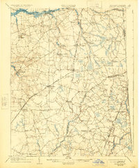
1905 Map of Barclay
USGS Topo · Published 1924About this map
The Chester River forms the northern boundary of this agricultural landscape, where the transition from water-based transport to rail is clearly visible at the start of the 20th century. Numerous river access points like Spry Landing and Deer Landing serve the northern border, while the Philadelphia Baltimore and Washington railroad cuts a diagonal path through the interior, anchoring towns like Barclay and Sudlersville. The presence of several distinct post offices, such as Tighman (Roberts P O) and Ashland (Hayden P O), highlights the localized nature of rural communication before modern consolidation.
Find a feature on this map
65 named features on this map. Tap any name to fly to it.
Don’t see what you’re looking for? This feature index may not catch every label — zoom into the map to look around manually.
Map Details
Editions of this 1905 Barclay Map
3 editions found
Other maps of this area

1898 · Choptank
USGS Topo · 1:125,000

1898 · Tolchester
USGS Topo · 1:125,000

1899 · Dover
USGS Topo · 1:125,000

1900 · Cecilton
USGS Topo · 1:62,500

1900 · Betterton
USGS Topo · 1:62,500

1901 · Chestertown
USGS Topo · 1:62,500

1903 · Tolchester
USGS Topo · 1:125,000

1904 · St. Michaels
USGS Topo · 1:62,500

1905 · Denton
USGS Topo · 1:62,500

1905 · Barclay
USGS Topo · 1:62,500