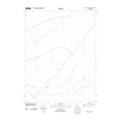
2010 Map of Barcus Creek
USGS Topo · Published 2010About this map
Pinto Mesa Windmill stands as a solitary landmark in this high-desert drainage basin within Rio Blanco County. The landscape is defined by the complex branching of Greasewood Creek and Barcus Creek, whose various forks—including the North Fork and East Fork—carve through the terrain. A sparse network of ranching roads, such as County Rd 89 and County Rd 122, provides the primary access across these remote canyons and gulches. The drainage patterns of Trail Canyon and Pinto Gulch illustrate the seasonal hydrology of the region, where water management features like windmills were essential for local land use. This 2010 survey reflects a largely undeveloped area where the topography is dominated by natural watercourses rather than human settlements.
Find a feature on this map
17 named features on this map. Tap any name to fly to it.
Don’t see what you’re looking for? This feature index may not catch every label — zoom into the map to look around manually.
Map Details
Editions of this 2010 Barcus Creek Map
This is the sole edition of this map. No revisions or reprints were ever made.
Other maps of this area

1907 · Rangely
USGS Topo · 1:125,000

1907 · White River
USGS Topo · 1:125,000

1910 · White River
USGS Topo · 1:125,000

1910 · Rangely
USGS Topo · 1:125,000

1952 · Wolf Ridge
USGS Topo · 1:24,000

1952 · Square S Ranch
USGS Topo · 1:24,000

1954 · Vernal
USGS Topo · 1:250,000

1956 · Grand Junction
USGS Topo · 1:250,000

1958 · Vernal
USGS Topo · 1:250,000

1959 · Grand Junction
USGS Topo · 1:250,000