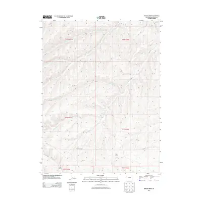
2013 Map of Barcus Creek
USGS Topo · Published 2013About this map
The Pinto Mesa Windmill stands as a lonely man-made landmark within this high-desert drainage system in Rio Blanco County. The landscape is defined by the complex branching of Barcus Creek and Greasewood Creek, where numerous tributaries such as the Middle Fork Greasewood Creek and North Barcus Creek have carved deep incisions into the plateau. This 2013 survey illustrates a sparsely populated region primarily utilized for resource management and ranching, evidenced by the network of unpaved thoroughfares like Co Road 88 and Co Road 122 that navigate the terrain. Large-scale geographic features such as Pinto Gulch and Trail Canyon dominate the southern portion of the quadrangle, while the appearance of Yellow Creek in the northeast corner marks the boundary of these distinct watershed systems.
Find a feature on this map
21 named features on this map. Tap any name to fly to it.
Don’t see what you’re looking for? This feature index may not catch every label — zoom into the map to look around manually.
Map Details
Editions of this 2013 Barcus Creek Map
This is the sole edition of this map. No revisions or reprints were ever made.
Other maps of this area

1907 · Rangely
USGS Topo · 1:125,000

1907 · White River
USGS Topo · 1:125,000

1910 · White River
USGS Topo · 1:125,000

1910 · Rangely
USGS Topo · 1:125,000

1952 · Wolf Ridge
USGS Topo · 1:24,000

1952 · Square S Ranch
USGS Topo · 1:24,000

1954 · Vernal
USGS Topo · 1:250,000

1956 · Grand Junction
USGS Topo · 1:250,000

1958 · Vernal
USGS Topo · 1:250,000

1959 · Grand Junction
USGS Topo · 1:250,000