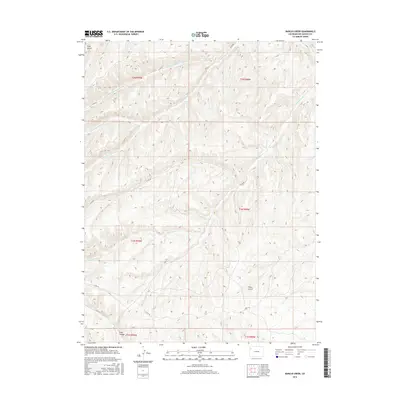
2016 Map of Barcus Creek
USGS Topo · Published 2016About this map
Barcus Creek and its various forks dominate this high-elevation terrain in Rio Blanco County, where deep drainages like Trail Canyon and Pinto Gulch carve through the Colorado landscape. This 2016 survey provides a clear look at the intricate watershed system feeding into Greasewood Cr, including the N Fork Greasewood Cr and Middle Fork Greasewood Cr. The map reveals a high-desert environment defined by its watercourses rather than settlements, showing how the land is segmented by township and range boundaries such as t1n r98w and t2n r99w. A network of rural routes, including Co RD 89 and Co RD 123, provides the only modern access through these winding valleys. The cartography highlights the complex topography of the Piceance Basin area, where seasonal creeks like Yellow Cr and N Barcus Cr illustrate the drainage patterns essential to this arid region's geography.
Find a feature on this map
22 named features on this map. Tap any name to fly to it.
Don’t see what you’re looking for? This feature index may not catch every label — zoom into the map to look around manually.
Map Details
Editions of this 2016 Barcus Creek Map
This is the sole edition of this map. No revisions or reprints were ever made.
Other maps of this area

1907 · Rangely
USGS Topo · 1:125,000

1907 · White River
USGS Topo · 1:125,000

1910 · White River
USGS Topo · 1:125,000

1910 · Rangely
USGS Topo · 1:125,000

1952 · Wolf Ridge
USGS Topo · 1:24,000

1952 · Square S Ranch
USGS Topo · 1:24,000

1954 · Vernal
USGS Topo · 1:250,000

1956 · Grand Junction
USGS Topo · 1:250,000

1958 · Vernal
USGS Topo · 1:250,000

1959 · Grand Junction
USGS Topo · 1:250,000