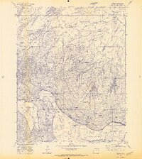
1971 Map of Barela
USGS Topo · Published 1973About this map
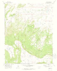
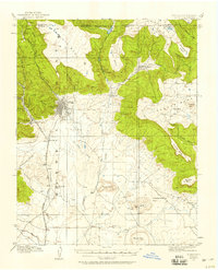
Barela and its surrounding mesa lands define this high-altitude landscape just north of the New Mexico state line in the early 1970s. The settlement is centered near the Barela Cem and sits along the Colorado and Southern railroad line, serving as a hub in an area dominated by prominent geological features like Barela Mesa and Burro Mesa. The map reveals a specialized local economy and infrastructure, from the Mararski Mine and various Gas Wells to the Raton Ski Basin located near the southern edge of the sheet. Numerous alpine water sources and family-named landmarks are scattered throughout the terrain, including Walton Lake No 1, Dominquez Lake, and Messer Plat Spring. The presence of an Airway Beacon on Burro Mesa and a network of Jeep Trails underscores the combination of traditional ranching or mining access with modern navigational and recreational needs.
Find a feature on this map
54 named features on this map. Tap any name to fly to it.
Don’t see what you’re looking for? This feature index may not catch every label — zoom into the map to look around manually.
Map Details
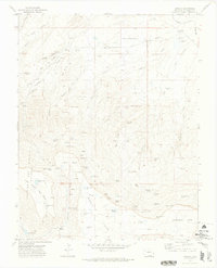
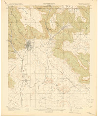
Editions of this 1971 Barela Map
3 editions found
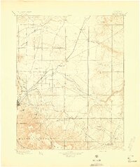
Other maps of this area

1892 · Elmoro
USGS Topo · 1:125,000

1893 · Elmoro
USGS Topo · 1:125,000
1897 · Elmoro
USGS Topo · 1:125,000
1912 · Raton
USGS Topo · 1:62,500
1914 · Raton
USGS Topo · 1:62,500

1954 · Raton
USGS Topo · 1:250,000

1954 · Trinidad
USGS Topo · 1:250,000

1955 · Trinidad
USGS Topo · 1:250,000

1958 · Raton
USGS Topo · 1:250,000

1958 · Trinidad
USGS Topo · 1:250,000