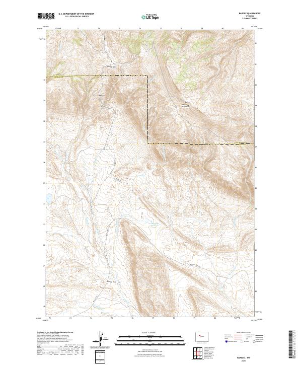
2021 Map of Bargee
USGS Topo · Published 2021About this map
The Owl Creek Mountains dominate the northern terrain of this quadrangle along the border of Hot Springs and Fremont counties. This landscape is defined by its seasonal watercourses and high-elevation crossings, most notably Blondy Pass. The drainage network includes Bargee Cr and Holland Cr, which flow through the western sections toward the Sagwup Draw. A few primary access routes, such as Mail Camp Rd and Stagner Rd, navigate the interior of the range, providing a window into the cattle ranching and resource management of the Wind River Basin. Further south, the presence of Madden Reservoir and Warm Springs indicates the essential role of water management in this arid environment. Traces of local history are etched into the nomenclature of the land, found in labels like McKee Grave Cr and the intersecting Shotgun Butte Rd.
Find a feature on this map
22 named features on this map. Tap any name to fly to it.
Don’t see what you’re looking for? This feature index may not catch every label — zoom into the map to look around manually.
Map Details
Editions of this 2021 Bargee Map
This is the sole edition of this map. No revisions or reprints were ever made.
Other maps of this area

1950 · Shotgun Butte
USGS Topo · 1:24,000

1951 · Eagle Point
USGS Topo · 1:24,000

1951 · Maverick Spring
USGS Topo · 1:24,000

1952 · Antelope Ridge
USGS Topo · 1:24,000

1952 · Sheep Ridge
USGS Topo · 1:24,000

1952 · Bargee
USGS Topo · 1:24,000

1955 · Thermopolis
USGS Topo · 1:250,000

1958 · Thermopolis
USGS Topo · 1:250,000

1962 · Thermopolis
USGS Topo · 1:250,000
1965 · Embar
USGS Topo · 1:24,000