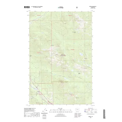
2020 Map of Baring
USGS Topo · Published 2020About this map
Baring sits at the foot of the massive granite peaks that define the junction of the South Fork Skykomish River and Index Cr. This 2020 survey of the Snoqualmie National Forest captures a landscape dominated by dramatic elevation changes, from the river valley floor to the towering summits of Gunn Peak and Baring Mtn. The map traces the intricate drainage networks of Barclay Cr and Trout Cr, which feed alpine water bodies like Barclay Lake and Eagle Lake. Significant topographic landmarks, including Merchant Peak and the high ridges of Klinger Ridge, illustrate the complex geology that separates the north and south forks of the Skykomish. While the settlement at Baring remains concentrated along the river corridor, the map reveals the extensive network of forest roads and trails, such as Barclay Creek Road (Snow), that provide access into the high meadows of Paradise Meadow.
Find a feature on this map
56 named features on this map. Tap any name to fly to it.
Don’t see what you’re looking for? This feature index may not catch every label — zoom into the map to look around manually.
Map Details
Editions of this 2020 Baring Map
This is the sole edition of this map. No revisions or reprints were ever made.
Other maps of this area

1902 · Skykomish
USGS Topo · 1:125,000

1905 · Skykomish
USGS Topo · 1:125,000

1921 · Sultan
USGS Topo · 1:125,000

1923 · Sultan
USGS Topo · 1:125,000

1957 · Index
USGS Topo · 1:62,500

1957 · Wenatchee
USGS Topo · 1:250,000

1960 · Mount Si
USGS Topo · 1:62,500

1965 · Evergreen Mtn
USGS Topo · 1:24,000

1965 · Grotto
USGS Topo · 1:24,000

1965 · Monte Cristo
USGS Topo · 1:24,000