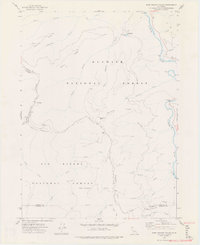
1974 Map of Bark Shanty Gulch
USGS Topo · Published 1977About this map
The Klamath River carves through the northeast corner of this mountainous region, where the R Lyle Davis Bridge provides a critical crossing. The landscape is defined by the overlap of the Klamath National Forest and Six Rivers National Forest, a terrain of steep drainages and prominent heights like Trail Mountain and Bald Mountain. The road network of the mid-1970s is limited, featuring the prominent G-O Road and several unimproved paths leading to remote outposts.
Find a feature on this map
38 named features on this map. Tap any name to fly to it.
Don’t see what you’re looking for? This feature index may not catch every label — zoom into the map to look around manually.
Map Details
Editions of this 1974 Bark Shanty Gulch Map
2 editions found
Other maps of this area

1914 · Seiad
USGS Topo · 1:125,000

1922 · Preston Peak
USGS Topo · 1:125,000

1922 · Seiad
USGS Topo · 1:125,000

1925 · Hoopa
USGS Topo · 1:125,000

1948 · Weed
USGS Topo · 1:250,000

1950 · Weed
USGS Topo · 1:250,000

1952 · Orleans
USGS Topo · 1:62,500

1955 · Dillon Mtn
USGS Topo · 1:62,500

1955 · Ukonom Lake
USGS Topo · 1:62,500

1955 · Forks of Salmon
USGS Topo · 1:62,500