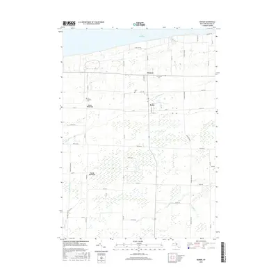
2016 Map of Barker
USGS Topo · Published 2016About this map
Lake Ontario borders the northern edge of this agricultural landscape in Niagara County, where the village of Barker serves as a central hub. The terrain is defined by a series of south-to-north drainage patterns, including Fish Cr, Golden Hill Cr, and Johnson Cr, which cut through the orchard-dotted countryside toward the Great Lake. The settlement pattern remains largely anchored to early nineteenth-century foundations, visible in the cluster of hamlets like Somerset, West Somerset, and North Hartland. Genealogy and local history are well-preserved through several dedicated burial grounds, including the Somerset Cem and the Quaker Cem. The grid of rural roads, such as Checkered Tavern Rd and Town Line Rd, reflects a persistent land-use pattern that has seen little change in its fundamental structure, maintaining the distinct character of this fruit-growing region near the New York shoreline.
Find a feature on this map
49 named features on this map. Tap any name to fly to it.
Don’t see what you’re looking for? This feature index may not catch every label — zoom into the map to look around manually.
Map Details
Editions of this 2016 Barker Map
This is the sole edition of this map. No revisions or reprints were ever made.
Other maps of this area

1897 · Olcott
USGS Topo · 1:62,500

1897 · Medina
USGS Topo · 1:62,500

1897 · Lockport
USGS Topo · 1:62,500

1897 · Ridgeway
USGS Topo · 1:62,500

1899 · Niagara
USGS Topo · 1:125,000

1902 · Lockport
USGS Topo · 1:62,500

1905 · Lockport
USGS Topo · 1:62,500

1948 · Lockport
USGS Topo · 1:62,500

1948 · Olcott
USGS Topo · 1:62,500
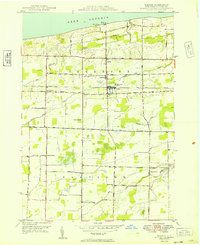
1949 · Barker
USGS Topo · 1:24,000