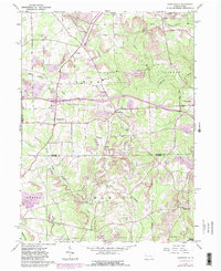
1963 Map of Barkeyville
USGS Topo · Published 1980About this map
Extensive oil fields and deep-cut creek valleys define the landscape of southern Venango County and its borders with Butler and Mercer. The map captures the industrial and agricultural rhythm of the early 1960s, with updates reflecting the arrival of major infrastructure like Interchange 3. Settled pockets such as Barkeyville and Clintonville serve as local hubs, while smaller crossroads like Nectarine and Wesley are marked by family-named churches and community landmarks including Amity Ch and Peters Chapel.
Find a feature on this map
36 named features on this map. Tap any name to fly to it.
Don’t see what you’re looking for? This feature index may not catch every label — zoom into the map to look around manually.
Map Details
Editions of this 1963 Barkeyville Map
4 editions found
Other maps of this area

1909 · Franklin
USGS Topo · 1:62,500

1910 · Hilliards
USGS Topo · 1:62,500

1911 · Franklin
USGS Topo · 1:62,500

1911 · Stoneboro
USGS Topo · 1:62,500

1912 · Hilliards
USGS Topo · 1:62,500

1913 · Stoneboro
USGS Topo · 1:62,500

1913 · Mercer
USGS Topo · 1:62,500

1939 · Mercer
USGS Topo · 1:62,500

1943 · Mercer
USGS Topo · 1:62,500

1943 · Stoneboro
USGS Topo · 1:62,500