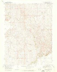
1970 Map of Barking Dog Spring
USGS Topo · Published 1973About this map
Barking Dog Spring and Picnic Springs serve as vital water sources in this dry expanse of Elbert County, where the high plains landscape is defined by a network of seasonal drainages. The terrain is marked by significant natural landmarks such as Cheyenne Lookout and the steep incisions of Devil Canyon. Settlement patterns in the early 1970s appear sparse, with the map showing few permanent structures, instead highlighting the utility of the land through a Gravel Pit and primitive transportation routes like the Jeep Trail. This area between Rattlesnake Creek and Beaver Creek reflects a quiet period of rural land use, primarily focused on ranching and resource extraction prior to more modern developments.
Find a feature on this map
10 named features on this map. Tap any name to fly to it.
Don’t see what you’re looking for? This feature index may not catch every label — zoom into the map to look around manually.
Map Details
Editions of this 1970 Barking Dog Spring Map
2 editions found
Other maps of this area

1891 · Limon
USGS Topo · 1:125,000

1892 · Limon
USGS Topo · 1:125,000

1954 · Limon
USGS Topo · 1:250,000

1957 · Limon
USGS Topo · 1:250,000

1958 · Limon
USGS Topo · 1:250,000
1969 · Noonen Reservoir SW
USGS Topo · 1:24,000

1970 · Agate
USGS Topo · 1:24,000
1970 · Beuck Draw
USGS Topo · 1:24,000

1970 · Limon
USGS Topo · 1:24,000
1970 · Barking Dog Spring
USGS Topo · 1:24,000