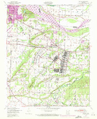
1947 Map of Barling
USGS Topo · Published 1971About this map
Fort Chaffee dominates the central and southern reaches of this landscape, its military infrastructure and landing fields established south of the Arkansas River. Originally surveyed in the late 1940s and revised in the early 1970s, the map illustrates the expansion of Barling and the industrial activity near Central City, including a visible strip mine. Local life is anchored by family-named landmarks and rural institutions such as St Marys Ch and Sch, Rye Hill Church, and the Howard Hill School. The northern border follows the river's path, featuring the Ozark Reservoir and public use areas near the dam sites. Transport across the terrain is defined by the Missouri Pacific railroad and a network of named boulevards, including Fort Smith Boulevard and Arkansas Boulevard, which connect the military reservation to the growing urban edges of Fort Smith.
Find a feature on this map
53 named features on this map. Tap any name to fly to it.
Don’t see what you’re looking for? This feature index may not catch every label — zoom into the map to look around manually.
Map Details
Editions of this 1947 Barling Map
2 editions found
Other maps of this area

1879 · Fort Smith
USGS Topo · 1:62,500

1887 · Van Buren
USGS Topo · 1:62,500

1887 · Greenwood
USGS Topo · 1:62,500

1890 · Fort Smith
USGS Topo · 1:125,000

1906 · Lavaca
USGS Topo · 1:62,500

1906 · Barber
USGS Topo · 1:62,500

1943 · Fort Smith
USGS Topo · 1:125,000

1946 · Fort Smith
USGS Topo · 1:250,000

1947 · Lavaca
USGS Topo · 1:62,500

1947 · Van Buren
USGS Topo · 1:62,500