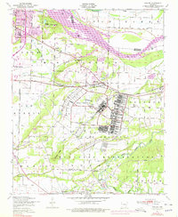
1947 Map of Barling
USGS Topo · Published 1978About this map
Fort Chaffee Military Reservation dominates the center of this landscape southeast of Fort Smith, revealing a complex grid of military infrastructure including an athletic field, landing field, and prominent chimneys. The 1940s-era topography, updated in the 1970s, captures the transition from rural Sebastian County holdings to a structured federal installation, while surrounding communities like Barling and Jenny Lind maintain their regional identity.
Find a feature on this map
46 named features on this map. Tap any name to fly to it.
Don’t see what you’re looking for? This feature index may not catch every label — zoom into the map to look around manually.
Map Details
Editions of this 1947 Barling Map
2 editions found
Other maps of this area

1879 · Fort Smith
USGS Topo · 1:62,500

1887 · Van Buren
USGS Topo · 1:62,500

1887 · Greenwood
USGS Topo · 1:62,500

1890 · Fort Smith
USGS Topo · 1:125,000

1906 · Lavaca
USGS Topo · 1:62,500

1906 · Barber
USGS Topo · 1:62,500

1943 · Fort Smith
USGS Topo · 1:125,000

1946 · Fort Smith
USGS Topo · 1:250,000

1947 · Lavaca
USGS Topo · 1:62,500

1947 · Van Buren
USGS Topo · 1:62,500