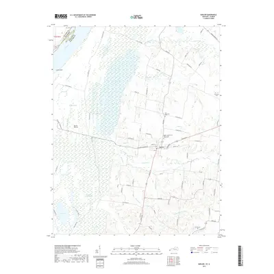
2019 Map of Barlow
USGS Topo · Published 2019About this map
Barlow sits at the edge of a complex wetland landscape in Ballard County, where the terrain shifts from upland ridges to the low-lying Barlow Bottoms. This environment is defined by a dense network of water bodies, including Swan Pond, Prairie Lake, and Twin Lake, which occupy the southern portion of the map. To the north, Brushy Pond and Clear Pond dominate the drainage system of Humphrey Creek and Sodom Creek. The map provides significant genealogical value through its documented burial sites, such as the Barlow - International Order of Odd Fellows Cemetery and the Old Hazelwood Cemetery. The transition between the alluvial plains near Cache Island on the Ohio River and the developed roads like Paducah Road reflects the historical balance between agricultural land and the natural hydrology of the western tip of Kentucky.
Find a feature on this map
74 named features on this map. Tap any name to fly to it.
Don’t see what you’re looking for? This feature index may not catch every label — zoom into the map to look around manually.
Map Details
Editions of this 2019 Barlow Map
This is the sole edition of this map. No revisions or reprints were ever made.
Other maps of this area

1928 · La Center
USGS Topo · 1:62,500

1931 · Cairo
USGS Topo · 1:62,500

1932 · La Center
USGS Topo · 1:62,500

1933 · Cairo
USGS Topo · 1:62,500

1939 · Wickliffe
USGS Topo · 1:62,500

1939 · Cairo
USGS Topo · 1:62,500

1949 · Paducah
USGS Topo · 1:250,000

1950 · Paducah
USGS Topo · 1:250,000

1951 · Blandville
USGS Topo · 1:24,000

1951 · Wickliffe
USGS Topo · 1:24,000