
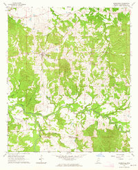
1963 Map of Barlow
USGS Topo · Published 1964About this map
Old Indian Treaty Boundary slices diagonally across this rural landscape, marking a deep historical division where Claiborne and Jefferson counties meet Copiah County. The southwestern portion is dominated by the dense woodlands of the Homochitto National Forest, where a road is noted as being Under Construction at the time of the 1963 field check. Settlement is concentrated around the small village of Barlow and the community of Allen to the south. The area is dense with family-named burial grounds and rural houses of worship, reflecting a tightly knit community structure. Genealogists can trace sites such as Hawkins Cem, Shelton Cem Ch, and Weeks Cem, which are scattered among the ridges and hollows carved by Little Bayou Pierre and Brandywine Creek.
Find a feature on this map
25 named features on this map. Tap any name to fly to it.
Don’t see what you’re looking for? This feature index may not catch every label — zoom into the map to look around manually.
Map Details
Editions of this 1963 Barlow Map
This is the sole edition of this map. No revisions or reprints were ever made.
Other maps of this area

1953 · Natchez
USGS Topo · 1:250,000

1956 · Natchez
USGS Topo · 1:250,000

1959 · Natchez
USGS Topo · 1:250,000

1963 · Dentville NW
USGS Topo · 1:24,000

1963 · Dentville
USGS Topo · 1:24,000

1963 · Smyrna
USGS Topo · 1:24,000

1963 · Union Church
USGS Topo · 1:62,500
1963 · Hermanville
USGS Topo · 1:24,000

1963 · McBride
USGS Topo · 1:24,000

1972 · Midway
USGS Topo · 1:24,000