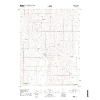
2017 Map of Barnard
USGS Topo · Published 2017About this map
Barnard serves as a central hub in this agricultural region of northwest Missouri, situated at the junction of State Hwy M and several local routes. The landscape is defined by the winding course of the One Hundred and Two River, which cuts through the western portion of the quadrangle, while the Platte River traces the eastern boundary. This area is characterized by a dense network of sectional roads, many following the original township and range lines of t62n r35w and t63n r35w.
Find a feature on this map
42 named features on this map. Tap any name to fly to it.
Don’t see what you’re looking for? This feature index may not catch every label — zoom into the map to look around manually.
Map Details
Editions of this 2017 Barnard Map
This is the sole edition of this map. No revisions or reprints were ever made.
Other maps of this area

1925 · Stanberry
USGS Topo · 1:62,500

1927 · Bolckow
USGS Topo · 1:62,500

1939 · Stanberry
USGS Topo · 1:62,500

1940 · Parnell
USGS Topo · 1:62,500

1943 · Parnell
USGS Topo · 1:62,500

1943 · Maryville
USGS Topo · 1:62,500

1943 · Stanberry
USGS Topo · 1:62,500

1945 · Bolckow
USGS Topo · 1:62,500

1955 · Nebraska City
USGS Topo · 1:250,000

1957 · Nebraska City
USGS Topo · 1:250,000