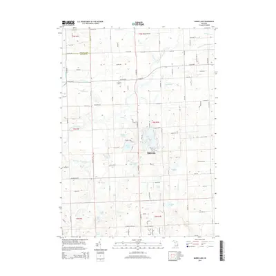
2014 Map of Barnes Lake
USGS Topo · Published 2014About this map
The Barnes Lake-Millers Lake residential area serves as the central focal point of this Lapeer County landscape, where clustered development around the shorelines contrasts with the surrounding agricultural sections of Rich and Deerfield Townships. Water defines the geography here, with the North Branch Flint River and South Branch Flint River meandering through the terrain alongside an extensive network of drainage systems like the Fostoria Drain and Kester Drain.
Find a feature on this map
113 named features on this map. Tap any name to fly to it.
Don’t see what you’re looking for? This feature index may not catch every label — zoom into the map to look around manually.
Map Details
Editions of this 2014 Barnes Lake Map
This is the sole edition of this map. No revisions or reprints were ever made.
Other maps of this area

1954 · Flint
USGS Topo · 1:250,000

1958 · Flint
USGS Topo · 1:250,000

1963 · Clifford
USGS Topo · 1:24,000

1963 · Attica
USGS Topo · 1:24,000

1963 · Mayville
USGS Topo · 1:24,000

1963 · North Branch
USGS Topo · 1:24,000

1963 · Columbiaville
USGS Topo · 1:24,000

1963 · Elba
USGS Topo · 1:24,000

1963 · Juniata
USGS Topo · 1:24,000
1963 · Barnes Lake
USGS Topo · 1:24,000
Featured Places
- Rich Township, MI
- Oregon Township, MI
- Watertown Township, MI
- Marathon Township, MI
- Mayfield Township, MI