
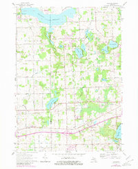
1963 Map of Elba
USGS Topo · Published 1964About this map
The Holloway Reservoir dominates the northern reaches of this Genesee and Lapeer County landscape, its waters controlled at a spillway near the Flint River gaging station. This early 1960s survey captures a transition between the developing northern outskirts of Davison and the rural townships of Richfield, Oregon, and Elba. The central and eastern portions are defined by a complex chain of glacial lakes, including Pero Lake, Skinner Lake, and Potters Lake, often connected by a series of engineered watercourses like the Fellows Drain and Washington Drain.
Find a feature on this map
67 named features on this map. Tap any name to fly to it.
Don’t see what you’re looking for? This feature index may not catch every label — zoom into the map to look around manually.
Map Details
Editions of this 1963 Elba Map
2 editions found
Other maps of this area

1920 · Flint
USGS Topo · 1:62,500

1920 · Holly
USGS Topo · 1:62,500

1922 · Holly
USGS Topo · 1:62,500

1922 · Flint
USGS Topo · 1:62,500

1943 · Holly
USGS Topo · 1:62,500

1943 · Flint
USGS Topo · 1:62,500

1943 · Metamora
USGS Topo · 1:24,000

1945 · Hadley
USGS Topo · 1:24,000

1946 · Metamora
USGS Topo · 1:24,000

1954 · Detroit
USGS Topo · 1:250,000