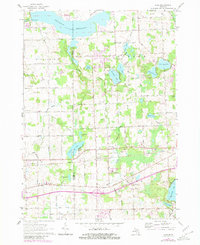
1963 Map of Elba
USGS Topo · Published 1980About this map
The Flint River valley and the expansive Holloway Reservoir dominate the northern landscape of this region, where the county line between Genesee and Lapeer counties divides rural townships. Settlement patterns here are defined by small crossroads and lakeside clusters, notably around the community of Elba and the industrial infrastructure of the New York Central railroad. Historically significant locations for genealogists include several well-placed burial grounds, such as Bentley Cem and St Johns Cem, which sit alongside early schools like German Sch and Shaft Sch.
Find a feature on this map
70 named features on this map. Tap any name to fly to it.
Don’t see what you’re looking for? This feature index may not catch every label — zoom into the map to look around manually.
Map Details
Editions of this 1963 Elba Map
2 editions found

Other maps of this area

1920 · Flint
USGS Topo · 1:62,500

1920 · Holly
USGS Topo · 1:62,500

1922 · Holly
USGS Topo · 1:62,500

1922 · Flint
USGS Topo · 1:62,500

1943 · Holly
USGS Topo · 1:62,500

1943 · Flint
USGS Topo · 1:62,500

1943 · Metamora
USGS Topo · 1:24,000

1945 · Hadley
USGS Topo · 1:24,000

1946 · Metamora
USGS Topo · 1:24,000

1954 · Detroit
USGS Topo · 1:250,000