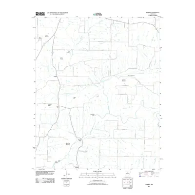
2011 Map of Barney
USGS Topo · Published 2011About this map
Mount Pleasant and the small hamlet of Barney anchor this 2011 survey of the Cleburne County uplands. The landscape is defined by a dense network of watercourses, including White Oak Creek, Mortar Creek, and Clear Creek, which carve through the terrain to form landmarks like Mansfield Bluff and the Devils Backbone. This area retains a strong connection to its early settlers through several family and community burial grounds, such as Mount Pleasant Cemetery, Mortar Creek Cemetery, and Brown Cemetery.
Find a feature on this map
68 named features on this map. Tap any name to fly to it.
Don’t see what you’re looking for? This feature index may not catch every label — zoom into the map to look around manually.
Map Details
Editions of this 2011 Barney Map
This is the sole edition of this map. No revisions or reprints were ever made.
Other maps of this area

1956 · Russellville
USGS Topo · 1:250,000

1961 · Conway
USGS Topo · 1:62,500

1961 · Bee Branch
USGS Topo · 1:62,500

1961 · Morganton
USGS Topo · 1:24,000

1961 · Guy
USGS Topo · 1:24,000
1961 · Holland
USGS Topo · 1:24,000

1963 · Rose Bud
USGS Topo · 1:24,000

1963 · Quitman
USGS Topo · 1:24,000

1963 · Enola
USGS Topo · 1:24,000

1963 · Mount Vernon
USGS Topo · 1:24,000