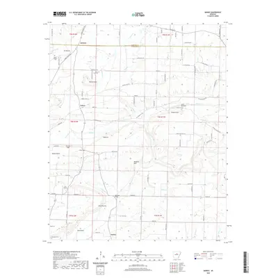
2020 Map of Barney
USGS Topo · Published 2020About this map
Quitman sits at the northern edge of this survey area, where the Cleburne and Faulkner county lines meet. The landscape is defined by the transition from the rolling terrain near Mt Pleasant down toward the drainages of Mortar Cr and Clear Cr. Local history is anchored by several rural burial grounds, including Mount Pleasant Cem and Mortar Creek Cem, which mark early settlement patterns near the communities of Enders and Barney.
Find a feature on this map
90 named features on this map. Tap any name to fly to it.
Don’t see what you’re looking for? This feature index may not catch every label — zoom into the map to look around manually.
Map Details
Editions of this 2020 Barney Map
This is the sole edition of this map. No revisions or reprints were ever made.
Other maps of this area

1956 · Russellville
USGS Topo · 1:250,000

1961 · Conway
USGS Topo · 1:62,500

1961 · Bee Branch
USGS Topo · 1:62,500

1961 · Morganton
USGS Topo · 1:24,000

1961 · Guy
USGS Topo · 1:24,000
1961 · Holland
USGS Topo · 1:24,000

1963 · Rose Bud
USGS Topo · 1:24,000

1963 · Quitman
USGS Topo · 1:24,000

1963 · Enola
USGS Topo · 1:24,000

1963 · Mount Vernon
USGS Topo · 1:24,000