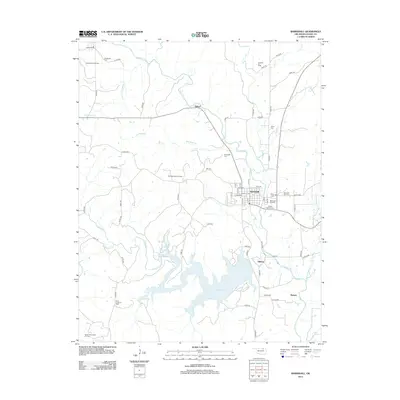
2012 Map of Barnsdall
USGS Topo · Published 2012About this map
The city of Barnsdall serves as the focal point for this landscape, defined by a dense concentration of petroleum extraction and water management. To the south, the expansive Birch Reservoir regulates the flow of Birch Creek, while the surrounding terrain is marked by numerous active resource areas including the Barnsdall Oil Field, West Barnsdall Oil Field, and Birch Creek South Oil Field. The area's Osage County heritage is preserved in several local burial grounds, such as the James Bigheart Cemetery and Red Eagle Cemetery. Small settlements like Tallant and Gilland bridge the gap between the industrial oil fields and the riparian corridors of Bird Creek and Cochahee Creek. This 2012 survey illustrates the continued importance of the energy sector alongside established residential grids and rural transport routes.
Find a feature on this map
73 named features on this map. Tap any name to fly to it.
Don’t see what you’re looking for? This feature index may not catch every label — zoom into the map to look around manually.
Map Details
Editions of this 2012 Barnsdall Map
This is the sole edition of this map. No revisions or reprints were ever made.
Other maps of this area

1906 · Nelagoney
USGS Topo · 1:24,000

1909 · Pawhuska
USGS Topo · 1:125,000

1910 · Pawhuska
USGS Topo · 1:125,000

1912 · Hominy
USGS Topo · 1:125,000

1915 · Hominy
USGS Topo · 1:125,000

1915 · Hominy
USGS Topo · 1:62,500

1955 · Enid
USGS Topo · 1:250,000

1958 · Enid
USGS Topo · 1:250,000

1960 · Nelagoney
USGS Topo · 1:24,000

1960 · Pawhuska
USGS Topo · 1:24,000