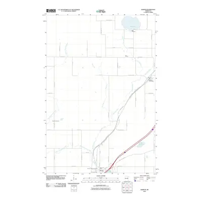
2010 Map of Barnum
USGS Topo · Published 2010About this map
The Moose Horn River and its western fork dominate this Carlton County landscape, flowing through the central settlements of Mahtowa and Barnum. This 2010 survey illustrates a region defined by its waterway network and the long-distance Willard Munger Trl which follows the historic rail corridor north through the river valley. The map documents essential local infrastructure such as the Barnum Post Office and the Mahtowa Post Office, alongside community landmarks like Riverside Cemetery and Salem Cemetery. To the north, Park Lake is regulated by the Park Lake Dam, while the surrounding terrain is gridded by rural routes like County Hwy-4 and County Hwy-140. The presence of the Barnum City Park Campground and the Ninefeldt Pool Dam further emphasizes the area's integration of recreational spaces with the natural river system.
Find a feature on this map
55 named features on this map. Tap any name to fly to it.
Don’t see what you’re looking for? This feature index may not catch every label — zoom into the map to look around manually.
Map Details
Editions of this 2010 Barnum Map
This is the sole edition of this map. No revisions or reprints were ever made.
Other maps of this area

1953 · Duluth
USGS Topo · 1:250,000

1954 · Atkinson
USGS Topo · 1:24,000

1954 · Iverson
USGS Topo · 1:24,000

1954 · Sawyer
USGS Topo · 1:24,000

1956 · Barnum
USGS Topo · 1:62,500

1958 · Duluth
USGS Topo · 1:250,000

1961 · Cromwell
USGS Topo · 1:62,500

1961 · Moose Lake
USGS Topo · 1:62,500

1962 · Bruno
USGS Topo · 1:62,500

1980 · Sandstone
USGS Topo · 1:100,000