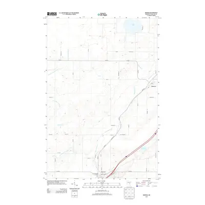
2013 Map of Barnum
USGS Topo · Published 2013About this map
Barnum serves as a local hub in Carlton County, situated where the Moose Horn River and several of its tributaries converge. This 2013 topographic survey captures the settlement patterns of the region, anchored by the municipal core of Barnum and the smaller community of Mahtowa to the northeast. The landscape is defined by its glacial hydrology, featuring numerous water bodies such as Park Lake, Lake Twentynine, and the secluded Ninefeldt Pool. For genealogists and local historians, the map identifies significant land use markers including Salem Cem and Riverside Cem, alongside recreation sites like the Barnum City Park Campground. The intricate network of local roads, such as Old Highway 61 and various township routes, provides a clear view of how these northern Minnesota communities are interconnected across the varied terrain.
Find a feature on this map
48 named features on this map. Tap any name to fly to it.
Don’t see what you’re looking for? This feature index may not catch every label — zoom into the map to look around manually.
Map Details
Editions of this 2013 Barnum Map
This is the sole edition of this map. No revisions or reprints were ever made.
Other maps of this area

1953 · Duluth
USGS Topo · 1:250,000

1954 · Atkinson
USGS Topo · 1:24,000

1954 · Iverson
USGS Topo · 1:24,000

1954 · Sawyer
USGS Topo · 1:24,000

1956 · Barnum
USGS Topo · 1:62,500

1958 · Duluth
USGS Topo · 1:250,000

1961 · Cromwell
USGS Topo · 1:62,500

1961 · Moose Lake
USGS Topo · 1:62,500

1962 · Bruno
USGS Topo · 1:62,500

1980 · Sandstone
USGS Topo · 1:100,000