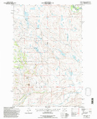
1995 Map of Barr Creek
USGS Topo · Published 1997About this map
The Sun River Wildlife Management Area dominates this mid-1990s landscape at the intersection of Lewis and Clark and Teton counties. This region is defined by its complex irrigation and water management systems, including the Geldrich Ditch and the Kirkaldie Canal, which divert water from the Sun River and Willow Creek to support local ranching. The presence of the Sun River Game Range Headquarters and the Morris Ranch reflects the dual use of the land for wildlife conservation and agricultural operations.
Find a feature on this map
22 named features on this map. Tap any name to fly to it.
Don’t see what you’re looking for? This feature index may not catch every label — zoom into the map to look around manually.
Map Details
Editions of this 1995 Barr Creek Map
This is the sole edition of this map. No revisions or reprints were ever made.
Other maps of this area

1903 · Saypo
USGS Topo · 1:125,000

1903 · Coopers Lake
USGS Topo · 1:125,000

1920 · Choteau
USGS Topo · 1:125,000

1943 · Hogan
USGS Topo · 1:125,000

1955 · Choteau
USGS Topo · 1:250,000

1957 · Choteau
USGS Topo · 1:250,000

1958 · Choteau
USGS Topo · 1:250,000

1958 · Barr Creek
USGS Topo · 1:24,000

1958 · Sawtooth Ridge
USGS Topo · 1:24,000

1958 · Castle Reef
USGS Topo · 1:24,000