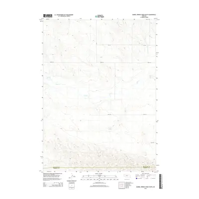
2014 Map of Barrel Springs Creek South
USGS Topo · Published 2014About this map
Snake Cr meanders across the high plains of the Nebraska Panhandle, carving a distinct east-west path through a landscape defined by rolling contours and seasonal water management. This area, spanning the border of Box Butte and Morrill counties, illustrates the region's reliance on localized water storage for agriculture and livestock. Key infrastructure includes the Cook SE Reservoir in the northwest and Tiernan Reservoir to the south, which capture runoff in an otherwise semi-arid environment. The mapping of Barrel Springs Creek in the northeastern corner further highlights the drainage patterns that have influenced land use in this part of the state. A grid of rural routes, including Otoe Rd and Perkins Rd, provides the primary access to the isolated ranchlands and farmsteads that characterize this western Nebraska terrain.
Find a feature on this map
9 named features on this map. Tap any name to fly to it.
Don’t see what you’re looking for? This feature index may not catch every label — zoom into the map to look around manually.
Map Details
Editions of this 2014 Barrel Springs Creek South Map
This is the sole edition of this map. No revisions or reprints were ever made.
Other maps of this area

1898 · Camp Clarke
USGS Topo · 1:125,000

1948 · Hemingford 4 SW
USGS Topo · 1:24,000

1948 · Hemingford 4 SE
USGS Topo · 1:24,000

1948 · Hemingford 4 NE
USGS Topo · 1:24,000

1948 · Hemingford 4 NW
USGS Topo · 1:24,000

1951 · Kilpatrick Lake
USGS Topo · 1:62,500

1954 · Scottsbluff
USGS Topo · 1:250,000

1955 · Alliance
USGS Topo · 1:250,000

1957 · Alliance
USGS Topo · 1:250,000

1958 · Alliance
USGS Topo · 1:250,000