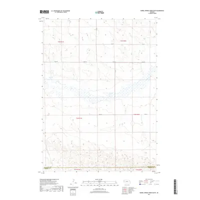
2017 Map of Barrel Springs Creek South
USGS Topo · Published 2017About this map
Snake Cr meanders across the high plains of the Nebraska Panhandle, defining the central drainage of this landscape as it appeared in 2017. The terrain transitions from the open tablelands of Township 25 North, Range 51 West down into the undulating breaks along the border between Box Butte and Morrill County. A network of rural section-line roads, including Otoe Rd and Perkins Rd, provides a framework for the agricultural activity and ranching that dominate the region.
Find a feature on this map
15 named features on this map. Tap any name to fly to it.
Don’t see what you’re looking for? This feature index may not catch every label — zoom into the map to look around manually.
Map Details
Editions of this 2017 Barrel Springs Creek South Map
This is the sole edition of this map. No revisions or reprints were ever made.
Other maps of this area

1898 · Camp Clarke
USGS Topo · 1:125,000

1948 · Hemingford 4 SW
USGS Topo · 1:24,000

1948 · Hemingford 4 SE
USGS Topo · 1:24,000

1948 · Hemingford 4 NE
USGS Topo · 1:24,000

1948 · Hemingford 4 NW
USGS Topo · 1:24,000

1951 · Kilpatrick Lake
USGS Topo · 1:62,500

1954 · Scottsbluff
USGS Topo · 1:250,000

1955 · Alliance
USGS Topo · 1:250,000

1957 · Alliance
USGS Topo · 1:250,000

1958 · Alliance
USGS Topo · 1:250,000