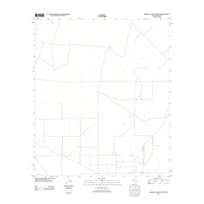
2012 Map of Barrilla Draw North
USGS Topo · Published 2012About this map
Reeves County rangeland and the open Texas landscape dominate this 2012 survey, revealing the precise grid of roads and ranch infrastructure characteristic of the Trans-Pecos region. The terrain is defined by a series of developed corridors, most notably the north-south passage of Ranch Road 2007. This artery connects the sparsely populated high desert to local transport networks, meeting with east-west routes like Co Rd-112 near the southern boundary. The survey provides a clear view of the area's rural character at the start of the 21st century, showing how modern land management and cattle ranching shape the contemporary geography of West Texas.
Find a feature on this map
2 named features on this map. Tap any name to fly to it.
Don’t see what you’re looking for? This feature index may not catch every label — zoom into the map to look around manually.
Map Details
Editions of this 2012 Barrilla Draw North Map
This is the sole edition of this map. No revisions or reprints were ever made.
Other maps of this area

1921 · Toyah
USGS Topo · 1:125,000

1931 · Barstow
USGS Topo · 1:125,000

1954 · Pecos
USGS Topo · 1:250,000

1955 · Saragosa
USGS Topo · 1:62,500

1957 · Pecos
USGS Topo · 1:250,000

1963 · Old X Ranch
USGS Topo · 1:24,000

1963 · Toyah Lake
USGS Topo · 1:24,000
1970 · Barstow 3 SW
USGS Topo · 1:24,000
1970 · Barstow 3 SE
USGS Topo · 1:24,000

1970 · Barstow 3 NE
USGS Topo · 1:24,000