
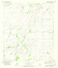
1970 Map of Barstow 3 NE
USGS Topo · Published 1973About this map
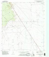
The Toro Gas Field dominates this landscape in Reeves County, reflecting the intensive energy development of West Texas during the late 1960s. The map captures a sprawling network of extraction infrastructure, from numerous Oil Wells and Gas Wells to the central Gas Plant and an extensive Pipeline system. These industrial features are interspersed with small, isolated outposts like Lanx, Hereford, and Flat Top Farm, which represent the thin residential and agricultural footprint in this arid region.
Find a feature on this map
15 named features on this map. Tap any name to fly to it.
Don’t see what you’re looking for? This feature index may not catch every label — zoom into the map to look around manually.
Map Details
Editions of this 1970 Barstow 3 NE Map
2 editions found
Other maps of this area

1931 · Barstow
USGS Topo · 1:125,000

1954 · Pecos
USGS Topo · 1:250,000

1957 · Pecos
USGS Topo · 1:250,000

1963 · Ligon Ranch
USGS Topo · 1:24,000

1963 · Old X Ranch
USGS Topo · 1:24,000

1963 · Toyah Lake
USGS Topo · 1:24,000
1970 · Barstow 3 SW
USGS Topo · 1:24,000
1970 · Barstow 3 SE
USGS Topo · 1:24,000
1970 · Barstow 3 NW
USGS Topo · 1:24,000
1973 · Coyanosa NW
USGS Topo · 1:24,000