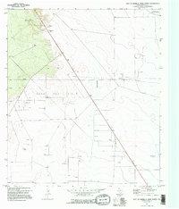
1970 Map of East Of Barrilla Draw North
USGS Topo · Published 1995About this map
The Toro Gas Field dominates this West Texas landscape, illustrating the intensive energy development of the late twentieth century near the transition to the Automotive Proving Ground in the northeast. This 1970 survey reveals a complex network of industrial infrastructure, characterized by numerous Gas Wells, Oil Wells, and a dedicated Gas Plant connected by an extensive Pipeline system. The presence of a localized Substa further emphasizes the heavy electrical requirements of these extraction operations.
Find a feature on this map
15 named features on this map. Tap any name to fly to it.
Don’t see what you’re looking for? This feature index may not catch every label — zoom into the map to look around manually.
Map Details
Editions of this 1970 East Of Barrilla Draw North Map
2 editions found
Other maps of this area

1931 · Barstow
USGS Topo · 1:125,000

1954 · Pecos
USGS Topo · 1:250,000

1957 · Pecos
USGS Topo · 1:250,000

1963 · Ligon Ranch
USGS Topo · 1:24,000

1963 · Old X Ranch
USGS Topo · 1:24,000

1963 · Toyah Lake
USGS Topo · 1:24,000
1970 · Barstow 3 SW
USGS Topo · 1:24,000
1970 · Barstow 3 SE
USGS Topo · 1:24,000

1970 · Barstow 3 NE
USGS Topo · 1:24,000
1970 · Barstow 3 NW
USGS Topo · 1:24,000