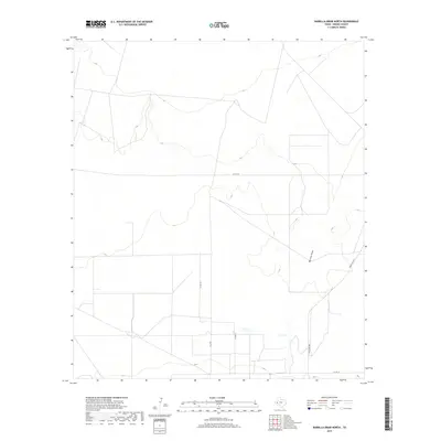
2019 Map of Barrilla Draw North
USGS Topo · Published 2019About this map
Barrilla Draw defines the drainage of this arid landscape in Reeves County, tracing a meandering path through the eastern portion of the quadrangle. The terrain is characterized by a sparse network of ranching and county roads, reflecting the large-scale land divisions common to this part of West Texas. Modern connectivity is provided by Ranch Rd 2007 and Co Rd 110, which cut across the survey lines and topographic contours. The map reveals a land structured by property boundaries and long, straight access routes like Co Rd 112 and K & D Rd, which serve the remote ranching interests of the region. This 2019 survey captures the persistent rural character of the high desert plains where water features like the draw remain the most significant natural landmarks among the established transit corridors.
Find a feature on this map
5 named features on this map. Tap any name to fly to it.
Don’t see what you’re looking for? This feature index may not catch every label — zoom into the map to look around manually.
Map Details
Editions of this 2019 Barrilla Draw North Map
This is the sole edition of this map. No revisions or reprints were ever made.
Other maps of this area

1921 · Toyah
USGS Topo · 1:125,000

1931 · Barstow
USGS Topo · 1:125,000

1954 · Pecos
USGS Topo · 1:250,000

1955 · Saragosa
USGS Topo · 1:62,500

1957 · Pecos
USGS Topo · 1:250,000

1963 · Old X Ranch
USGS Topo · 1:24,000

1963 · Toyah Lake
USGS Topo · 1:24,000
1970 · Barstow 3 SW
USGS Topo · 1:24,000
1970 · Barstow 3 SE
USGS Topo · 1:24,000

1970 · Barstow 3 NE
USGS Topo · 1:24,000