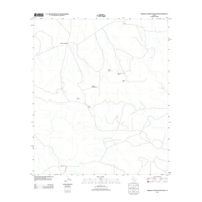
2012 Map of Barrilla Mountains East
USGS Topo · Published 2012About this map
Cuatro Caminos marks a remote junction in the West Texas landscape, where the high desert terrain of Reeves County meets the prominent volcanic formations of the Barrilla Mountains. This map documents a region defined by its reliance on scarce water sources, as seen through markers such as Mexican Spring, Borregus Tank, and Beard Spring, which are essential for livestock and the local ranching economy. The presence of U Ranch and South Camp indicates the scale of agricultural operations in this arid expanse, where landmarks like Negro Head and Mouflon Reef provide topographical orientation. Transport is facilitated by rural routes such as Limpia Creek Rd and Jeff Ranch Rd, connecting isolated windmill sites like Pipe Windmill across the dissected landscape.
Find a feature on this map
13 named features on this map. Tap any name to fly to it.
Don’t see what you’re looking for? This feature index may not catch every label — zoom into the map to look around manually.
Map Details
Editions of this 2012 Barrilla Mountains East Map
This is the sole edition of this map. No revisions or reprints were ever made.
Other maps of this area

1894 · Fort Davis
USGS Topo · 1:125,000

1897 · Fort Davis
USGS Topo · 1:125,000

1929 · Hovey
USGS Topo · 1:125,000

1954 · Fort Stockton
USGS Topo · 1:250,000

1958 · Fort Stockton
USGS Topo · 1:250,000

1970 · Deep Well Ranch
USGS Topo · 1:24,000
1970 · Deep Well Ranch NW
USGS Topo · 1:24,000

1973 · Fort Stockton
USGS Topo · 1:250,000
1980 · Cox Draw
USGS Topo · 1:24,000
1980 · Balmorhea
USGS Topo · 1:24,000