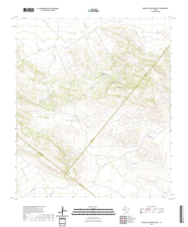
2022 Map of Barrilla Mountains East
USGS Topo · Published 2022About this map
Henry Flipper Hill and Beard Mtn define the high ground of this West Texas landscape where the boundaries of Reeves, Pecos, and Jeff Davis counties converge. The terrain is characterized by a network of drainage features, including Carrizo Draw, South Carrizo Draw, and Lochousen Canyon, which demonstrate the complex hydrology of the High Desert. Critical water sources, essential for ranching and survival in this arid environment, are marked at Barrilla Spring, Mexican Spring, and Beard Spring. The map also identifies Borregus Tank and Mouflon Reef, illustrating the intersection of natural topography and land-use improvements. Access to these remote reaches is maintained via Jeff Ranch Rd and Limpia Creek Rd, which navigate the draws and rises typical of this trans-Pecos region.
Find a feature on this map
19 named features on this map. Tap any name to fly to it.
Don’t see what you’re looking for? This feature index may not catch every label — zoom into the map to look around manually.
Map Details
Editions of this 2022 Barrilla Mountains East Map
This is the sole edition of this map. No revisions or reprints were ever made.
Other maps of this area

1894 · Fort Davis
USGS Topo · 1:125,000

1897 · Fort Davis
USGS Topo · 1:125,000

1929 · Hovey
USGS Topo · 1:125,000

1954 · Fort Stockton
USGS Topo · 1:250,000

1958 · Fort Stockton
USGS Topo · 1:250,000

1970 · Deep Well Ranch
USGS Topo · 1:24,000
1970 · Deep Well Ranch NW
USGS Topo · 1:24,000

1973 · Fort Stockton
USGS Topo · 1:250,000
1980 · Cox Draw
USGS Topo · 1:24,000
1980 · Balmorhea
USGS Topo · 1:24,000