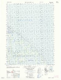
1962 Map of Barrow A-1
USGS Topo · Published 1962About this map
Naval Petroleum Reserve No 4 dominates this Arctic coastal landscape, reflecting the mid-century push for energy exploration in the far north. The map documents early industrial activity with labels for the Simpson Test Well No 1 and a cluster of Test wells No 13-24 near the shores of Sinclair Lake. These markers, along with an isolated Airstrip and scattered Ruins, trace the human footprint in a region defined by its seasonal access and specialized transit.
Find a feature on this map
15 named features on this map. Tap any name to fly to it.
Don’t see what you’re looking for? This feature index may not catch every label — zoom into the map to look around manually.
Map Details
Editions of this 1962 Barrow A-1 Map
This is the sole edition of this map. No revisions or reprints were ever made.
Other maps of this area

1945 · Barrow
USGS Topo · 1:250,000

1949 · Barrow
USGS Topo · 1:250,000

1951 · Teshekpuk
USGS Topo · 1:250,000

1955 · Barrow A-2
USGS Topo · 1:63,360

1955 · Barrow
USGS Topo · 1:250,000

1955 · Teshekpuk
USGS Topo · 1:250,000
1955 · Barrow A-1
USGS Topo · 1:63,360
1955 · Teshekpuk D-3
USGS Topo · 1:63,360

1955 · Teshekpuk D-4
USGS Topo · 1:63,360

1964 · Teshekpuk
USGS Topo · 1:250,000