
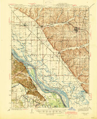
1944 Map of Barry
USGS Topo · Published 1944About this map
The Mississippi River floodplain dominates this mid-1940s landscape, weaving a complex network of sloughs, chutes, and islands across the Illinois-Missouri border. The intricate river geography is marked by landmarks like Cincinnati Landing and Mundy Ldg, alongside several named islands such as Browns Island and Gilbert Island. To the east, the terrain rises into the bluffs of Pike County, where a dense network of country schools, including Diamond Hill Sch and Whittleton Sch, served the upland farming communities.
Find a feature on this map
123 named features on this map. Tap any name to fly to it.
Don’t see what you’re looking for? This feature index may not catch every label — zoom into the map to look around manually.
Map Details
Editions of this 1944 Barry Map
2 editions found
Other maps of this area

1890 · Louisiana
USGS Topo · 1:125,000

1925 · Quincy
USGS Topo · 1:62,500

1925 · Liberty
USGS Topo · 1:62,500

1926 · Pittsfield
USGS Topo · 1:62,500

1926 · Mt Sterling
USGS Topo · 1:62,500

1927 · Liberty
USGS Topo · 1:62,500

1929 · Mt Sterling
USGS Topo · 1:62,500

1930 · Nebo
USGS Topo · 1:62,500

1931 · Barry
USGS Topo · 1:62,500

1932 · Hannibal
USGS Topo · 1:62,500