
1955 Map of Barter Island A-5
USGS Topo · Published 1969About this map
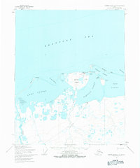
Kaktovik sits at the center of this 1955 survey of the northern Alaskan coast, positioned on Barter Island between the Beaufort Sea and Kaktovik Lagoon. The map details a landscape defined by coastal features like Arey Island and the Bernard Spit, which shelter several large bodies of water including Arey Lagoon and Bernard Harbor. On the mainland to the south, the Okpilak River winds through a network of smaller lakes and marshes within the Arctic National Wildlife Range.
Find a feature on this map
25 named features on this map. Tap any name to fly to it.
Don’t see what you’re looking for? This feature index may not catch every label — zoom into the map to look around manually.
Map Details
Editions of this 1955 Barter Island A-5 Map
3 editions found
Other maps of this area

1951 · Barter Island
USGS Topo · 1:250,000

1951 · Demarcation Point
USGS Topo · 1:250,000

1951 · Mt. Michelson
USGS Topo · 1:250,000

1955 · Flaxman Island
USGS Topo · 1:250,000

1955 · Demarcation Point
USGS Topo · 1:250,000

1955 · Flaxman Island A-1
USGS Topo · 1:63,360

1955 · Barter Island A-4
USGS Topo · 1:63,360

1955 · Mount Michelson D-1
USGS Topo · 1:63,360

1955 · Demarcation Point D-5
USGS Topo · 1:63,360

1955 · Demarcation Point D-4
USGS Topo · 1:63,360