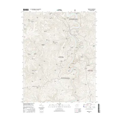
2016 Map of Barthell
USGS Topo · Published 2016About this map
The Big South Fork National River and Recreation Area dominates this section of the Cumberland Plateau, where the Big South Fork Cumberland River carves a deep path through McCreary County. This landscape is defined by its complex topography of ridges and hollows, such as Mine Ten Ridge and Alum Cave Hollow, which historically dictated the placement of small mining and logging communities. Settlements like Blue Heron and Barthell are centers of local history, while more isolated locations like Co-Operative and White Oak Junction show the traditional patterns of upland habitation.
Find a feature on this map
100 named features on this map. Tap any name to fly to it.
Don’t see what you’re looking for? This feature index may not catch every label — zoom into the map to look around manually.
Map Details
Editions of this 2016 Barthell Map
This is the sole edition of this map. No revisions or reprints were ever made.
Other maps of this area

1890 · Williamsburg
USGS Topo · 1:125,000

1894 · Williamsburg
USGS Topo · 1:125,000

1932 · Burnside
USGS Topo · 1:62,500

1934 · Barthell
USGS Topo · 1:62,500

1952 · Wiborg
USGS Topo · 1:24,000

1952 · Whitley City
USGS Topo · 1:24,000
1953 · Winfield
USGS Topo · 1:24,000

1954 · Coopersville
USGS Topo · 1:24,000
1954 · Nevelsville
USGS Topo · 1:24,000
1954 · Barthell
USGS Topo · 1:24,000