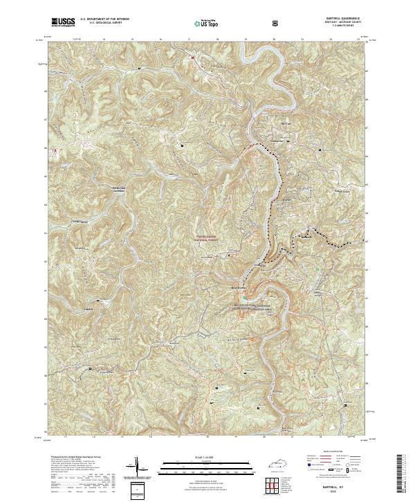
2022 Map of Barthell
USGS Topo · Published 2022About this map
Yamacraw and the nearby settlements of Worley and Barthell sit at the heart of this McCreary County landscape, where the coal mining and timber legacies of the Cumberland Plateau are preserved within the Daniel Boone National Forest. The map documents the industrial transit of the K & T Railroad, which once served the mines in the Big South Fork National River and Recreation Area. Along the Big South Fork, features like Devil Jump Rapids and Big Shoals define the river's character, while the surrounding ridges are dotted with small family burial grounds such as Chitwood Cem and the Hickman Cem. The concentration of company towns like Blue Heron and Co-Operative illustrates the region's historical reliance on extraction and rail infrastructure in a topography defined by steep ridges like Rattlesnake Ridge and deep hollows.
Find a feature on this map
115 named features on this map. Tap any name to fly to it.
Don’t see what you’re looking for? This feature index may not catch every label — zoom into the map to look around manually.
Map Details
Editions of this 2022 Barthell Map
This is the sole edition of this map. No revisions or reprints were ever made.
Other maps of this area

1890 · Williamsburg
USGS Topo · 1:125,000

1894 · Williamsburg
USGS Topo · 1:125,000

1932 · Burnside
USGS Topo · 1:62,500

1934 · Barthell
USGS Topo · 1:62,500

1952 · Wiborg
USGS Topo · 1:24,000

1952 · Whitley City
USGS Topo · 1:24,000
1953 · Winfield
USGS Topo · 1:24,000

1954 · Coopersville
USGS Topo · 1:24,000
1954 · Nevelsville
USGS Topo · 1:24,000
1954 · Barthell
USGS Topo · 1:24,000