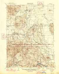
1939 Map of Bartle
USGS Topo · Published 1947About this map
The McCloud River RR serves as a vital artery through this timber-rich portion of the Cascade Range, connecting isolated camps and railheads across the Siskiyou and Shasta border. The settlement of Bartle sits at the nexus of these rail operations, while Pondosa and Hambone mark significant points of human activity amidst the volcanic terrain. This 1932 field survey, published shortly after World War II, captures a landscape defined by forest management and emerging recreation, evidenced by numerous fire prevention posts like the Arvison Flat Guard Sta and the Harris Spring Guard Sta.
Find a feature on this map
70 named features on this map. Tap any name to fly to it.
Don’t see what you’re looking for? This feature index may not catch every label — zoom into the map to look around manually.
Map Details
Editions of this 1939 Bartle Map
3 editions found

Other maps of this area

1886 · Lassen Peak
USGS Topo · 1:250,000

1886 · Modoc Lava Bed
USGS Topo · 1:250,000

1886 · Shasta
USGS Topo · 1:250,000

1890 · Red Bluff
USGS Topo · 1:250,000

1892 · Modoc Lava-Bed
USGS Topo · 1:250,000

1892 · Lassen Peak
USGS Topo · 1:250,000

1894 · Lassen Peak
USGS Topo · 1:250,000

1894 · Red Bluff
USGS Topo · 1:250,000

1894 · Shasta
USGS Topo · 1:250,000

1901 · Redding
USGS Topo · 1:125,000