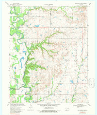
1970 Map of Bartlesville SE
USGS Topo · Published 1987About this map
The Caney River meanders across the western half of this landscape, its wide oxbows and floodplains defining the topography of Madison. East of the river, the terrain transitions into the upland drainage basins of Watova and Talala, where numerous streams like Timberlake Creek and Stick Creek carve through the Oklahoma countryside. This 1970 survey captures the region's intersection of natural waterways and early energy extraction, noted by an Oil Well and a Gravel Pit near the southern boundary.
Find a feature on this map
21 named features on this map. Tap any name to fly to it.
Don’t see what you’re looking for? This feature index may not catch every label — zoom into the map to look around manually.
Map Details
Editions of this 1970 Bartlesville SE Map
2 editions found

Other maps of this area

1901 · Claremore
USGS Topo · 1:125,000

1901 · Nowata
USGS Topo · 1:125,000

1914 · Nowata
USGS Topo · 1:125,000

1914 · Claremore
USGS Topo · 1:125,000

1916 · Claremore
USGS Topo · 1:125,000

1954 · Tulsa
USGS Topo · 1:250,000

1958 · Tulsa
USGS Topo · 1:250,000

1959 · Collinsville NE
USGS Topo · 1:24,000
1959 · Vera
USGS Topo · 1:24,000

1963 · Tulsa
USGS Topo · 1:250,000