1961 Map of Bartlett
USGS Topo · Published 1961About this map
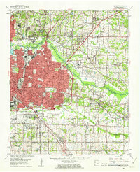
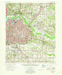
Memphis expands eastward toward Bartlett and Germantown in this early 1960s survey, showing the post-war transition of Shelby County from rural farmsteads to suburban infrastructure. The landscape is defined by the winding course of the Wolf River and Nonconnah Creek, which frame the major transportation corridors of Summer Ave and Poplar Ave. Significant institutional footprints include the sprawling Memphis General Depot and the Penal Farm, contrasting with established academic centers like Southwestern University and Siena College.
Find a feature on this map
74 named features on this map. Tap any name to fly to it.
Don’t see what you’re looking for? This feature index may not catch every label — zoom into the map to look around manually.
Map Details
Editions of this 1961 Bartlett Map
This is the sole edition of this map. No revisions or reprints were ever made.