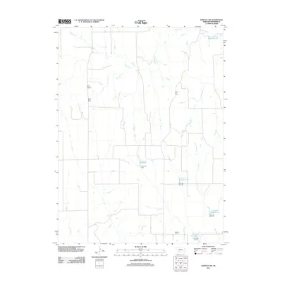
2011 Map of Bartley NW
USGS Topo · Published 2011About this map
Saint Thomas Cemetery and several rural schoolhouses define the social geography of this section of Frontier County. The landscape is a network of water management features and drainage systems, where Sughroue Reservoir and multiple catchments along Dry Creek suggest a highly managed agricultural environment. These reservoirs, including Dry Creek Reservoir 1-B and Dry Creek Reservoir 2-A, are paired with named infrastructure like Sughroue Dam, illustrating the local reliance on irrigation and flood control in the High Plains.
Find a feature on this map
18 named features on this map. Tap any name to fly to it.
Don’t see what you’re looking for? This feature index may not catch every label — zoom into the map to look around manually.
Map Details
Editions of this 2011 Bartley NW Map
This is the sole edition of this map. No revisions or reprints were ever made.
Other maps of this area

1902 · Gothenburg
USGS Topo · 1:125,000

1954 · McCook
USGS Topo · 1:250,000

1956 · Freedom
USGS Topo · 1:24,000

1956 · Quick NE
USGS Topo · 1:24,000

1956 · Curtis SE
USGS Topo · 1:24,000

1956 · Stockville
USGS Topo · 1:24,000

1956 · Bartley NW
USGS Topo · 1:24,000

1956 · Bartley
USGS Topo · 1:24,000

1956 · Stockville SE
USGS Topo · 1:24,000

1957 · McCook
USGS Topo · 1:250,000