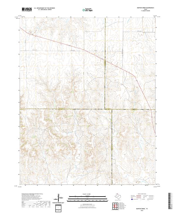
2022 Map of Barton Creek
USGS Topo · Published 2022About this map
Locust Grove stands as a focal point in this portion of the Texas Panhandle, situated in a landscape defined by the intricate drainages of the High Plains. The area is marked by the convergence of four distinct counties—Ochiltree, Roberts, Lipscomb, and Hemphill—creating a unique political geography where their boundaries meet. Watercourses like Barton Creek, Gibson Creek, and Buffalo Creek cut through the terrain, illustrating the natural erosion patterns of the region. Transportation across these rural expanses relies on a network of routes such as Ranch Rd 281 and Ranch Rd 1265, which connect isolated homesteads and ranching operations. The mapping of Morgan Creek in the southeastern corner further emphasizes the importance of these seasonal or intermittent streams to the local environment and land use.
Find a feature on this map
15 named features on this map. Tap any name to fly to it.
Don’t see what you’re looking for? This feature index may not catch every label — zoom into the map to look around manually.
Map Details
Editions of this 2022 Barton Creek Map
This is the sole edition of this map. No revisions or reprints were ever made.
Other maps of this area

1954 · Perryton
USGS Topo · 1:250,000

1954 · Amarillo
USGS Topo · 1:250,000

1958 · Perryton
USGS Topo · 1:250,000

1958 · Amarillo
USGS Topo · 1:250,000

1972 · Barton Corners
USGS Topo · 1:24,000

1972 · Horse Creek North
USGS Topo · 1:24,000

1972 · Canadian West
USGS Topo · 1:24,000

1972 · East Dry Creek
USGS Topo · 1:24,000
1972 · Lipscomb SW
USGS Topo · 1:24,000

1973 · Pickett Ranch Creek
USGS Topo · 1:24,000