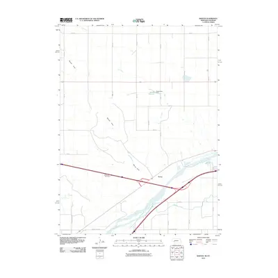
2010 Map of Barton
USGS Topo · Published 2010About this map
The South Platte River valley defines the lower portion of this landscape, where the Western Canal parallels the river's path through Deuel County. Near the small settlement of Barton, the river splits and winds around islands, while irrigation infrastructure is visible through features like the Beasley Dam 25-01 and the associated Beasley Reservoir. The northern terrain is characterized by large agricultural blocks and the deep incision of Walrath Draw, which drains toward the river valley.
Find a feature on this map
25 named features on this map. Tap any name to fly to it.
Don’t see what you’re looking for? This feature index may not catch every label — zoom into the map to look around manually.
Map Details
Editions of this 2010 Barton Map
This is the sole edition of this map. No revisions or reprints were ever made.
Other maps of this area

1900 · Chappell
USGS Topo · 1:125,000

1953 · Julesburg
USGS Topo · 1:24,000

1954 · Sterling
USGS Topo · 1:250,000

1954 · Scottsbluff
USGS Topo · 1:250,000

1958 · Scottsbluff
USGS Topo · 1:250,000

1958 · Sterling
USGS Topo · 1:250,000

1961 · Barton
USGS Topo · 1:24,000

1961 · Big Springs
USGS Topo · 1:24,000

1961 · Chappell SE
USGS Topo · 1:24,000
1962 · Venango NE
USGS Topo · 1:24,000