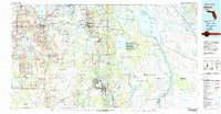
1978 Map of Bartow
USGS Topo · Published 1980About this map
The phosphate mining districts of West Central Florida define the western landscape of this 1978 survey, where numerous Strip Mine operations and industrial hubs like Mulberry and Bradley Junction contrast with the agricultural and recreational areas to the east. The Seaboard Coast Line railroad network serves as the backbone for these industries, connecting settlements such as Pierce, Agricola, and Homeland through the heart of Bartow.
Find a feature on this map
123 named features on this map. Tap any name to fly to it.
Don’t see what you’re looking for? This feature index may not catch every label — zoom into the map to look around manually.
Map Details
Editions of this 1978 Bartow Map
2 editions found
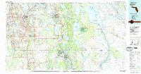
Other maps of this area

1944 · Plant City
USGS Topo · 1:31,680

1944 · Lakeland
USGS Topo · 1:31,680

1944 · Auburndale
USGS Topo · 1:31,680

1949 · Mulberry
USGS Topo · 1:24,000

1949 · Bartow
USGS Topo · 1:24,000

1949 · Bradley Junction
USGS Topo · 1:24,000

1950 · Mulberry
USGS Topo · 1:24,000

1950 · Bartow
USGS Topo · 1:24,000

1950 · Bradley Junction
USGS Topo · 1:24,000

1952 · Homeland
USGS Topo · 1:24,000