
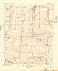
1918 Map of Barwise School
USGS Topo · Published 1918About this map
Barwise School and Sunshine School serve as primary landmarks in this 1915 survey of northern Wichita County, where rural education was central to the dispersed farming community. The landscape is defined by a dendritic network of drainages, including the North Fork Buffalo Creek, Long Creek, and the uniquely named Tenth Cavalry Creek. These waterways carve through the terrain, dictating the placement of early travel routes.
Find a feature on this map
14 named features on this map. Tap any name to fly to it.
Don’t see what you’re looking for? This feature index may not catch every label — zoom into the map to look around manually.
Map Details
Editions of this 1918 Barwise School Map
2 editions found
Other maps of this area

1915 · Clara
USGS Topo · 1:24,000

1915 · Barwise School
USGS Topo · 1:24,000

1916 · Electra
USGS Topo · 1:24,000

1916 · Iowa Park
USGS Topo · 1:24,000

1916 · Fowlkes
USGS Topo · 1:24,000

1917 · Beaver Creek
USGS Topo · 1:24,000

1918 · Electra
USGS Topo · 1:31,680

1918 · Clara
USGS Topo · 1:31,680

1918 · Iowa Park
USGS Topo · 1:31,680

1919 · Fowlkes
USGS Topo · 1:31,680