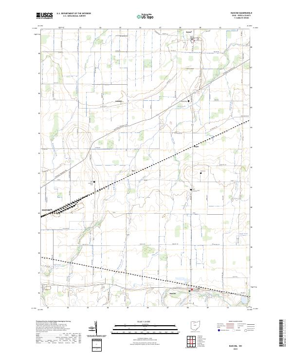
2023 Map of Bascom
USGS Topo · Published 2023About this map
Agricultural lands and a network of small crossroad settlements define this portion of Seneca County. The landscape is heavily marked by a complex system of drainage ditches, including Sherger Ditch, Lynch Ditch, and Walz Ditch, which support the intensive farming traditional to this region. Several small communities anchor the area, from Kansas and Amsden in the north to Bascom in the south, while the outskirts of Fostoria occupy the southwestern corner.
Find a feature on this map
87 named features on this map. Tap any name to fly to it.
Don’t see what you’re looking for? This feature index may not catch every label — zoom into the map to look around manually.
Map Details
Editions of this 2023 Bascom Map
This is the sole edition of this map. No revisions or reprints were ever made.
Other maps of this area

1901 · Fostoria
USGS Topo · 1:62,500

1901 · Fremont
USGS Topo · 1:62,500

1901 · Elmore
USGS Topo · 1:62,500

1903 · Fremont
USGS Topo · 1:62,500

1903 · Fostoria
USGS Topo · 1:62,500

1903 · Elmore
USGS Topo · 1:62,500

1906 · Tiffin
USGS Topo · 1:62,500

1956 · Toledo
USGS Topo · 1:250,000

1958 · Fremont West
USGS Topo · 1:24,000
1958 · Bradner
USGS Topo · 1:24,000