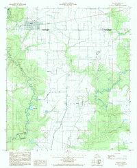
1985 Map of Basile
USGS Topo · Published 1985About this map
The town of Basile anchors this survey of the Louisiana prairie, where the convergence of several parish boundaries—including Evangeline Parish and Allen Parish—defines the administrative landscape. The area is heavily marked by its water systems and resource extraction, with the Mamou Canal and Bayou Nezpique providing drainage across the flat terrain. Evidence of the region's petroleum industry is prominent, particularly the Oil Field located near Tepetate and Redich.
Find a feature on this map
19 named features on this map. Tap any name to fly to it.
Don’t see what you’re looking for? This feature index may not catch every label — zoom into the map to look around manually.
Map Details
Editions of this 1985 Basile Map
2 editions found
Other maps of this area

1947 · Evangeline
USGS Topo · 1:31,680

1947 · Fruge Lake
USGS Topo · 1:31,680

1947 · Redland
USGS Topo · 1:31,680

1947 · Elton
USGS Topo · 1:31,680

1947 · Eunice
USGS Topo · 1:31,680

1947 · Hathaway
USGS Topo · 1:31,680

1947 · Iota
USGS Topo · 1:31,680

1947 · Basile
USGS Topo · 1:31,680

1949 · Bayou Blue
USGS Topo · 1:31,680

1949 · Basile
USGS Topo · 1:31,680