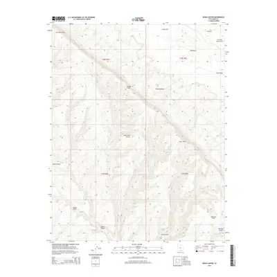
2014 Map of Basin Canyon
USGS Topo · Published 2014About this map
Kaiparowits Plateau dominates this landscape, defined by the dramatic verticality of the Straight Cliffs. The terrain drops away from the high plateau to the Fiftymile Bench, creating a stepped topography that has historically dictated access through this portion of Kane County. The network of drainages including Basin Canyon, Rogers Canyon, and Willow Gulch demonstrates the complex erosion patterns characteristic of the region. This 2014 survey captures the area's land management divisions, showing the township and range lines of T38S and T39S. Prominent landmarks such as Black Ridge and West End Point provide orientation across the high-elevation flats like Sunset Flat and Cat Pasture. The geography here emphasizes the isolation and physical barriers created by the cliffs, where water features like Dry Fork Coyote Gulch are the primary agents of change in the arid environment.
Find a feature on this map
18 named features on this map. Tap any name to fly to it.
Don’t see what you’re looking for? This feature index may not catch every label — zoom into the map to look around manually.
Map Details
Editions of this 2014 Basin Canyon Map
This is the sole edition of this map. No revisions or reprints were ever made.
Other maps of this area

1886 · Escalante
USGS Topo · 1:250,000

1922 · Rees Canyon
USGS Topo · 1:63,360

1953 · Circle Cliffs 4 SW
USGS Topo · 1:24,000

1953 · Moody Creek
USGS Topo · 1:62,500

1956 · Escalante
USGS Topo · 1:250,000

1960 · Escalante
USGS Topo · 1:250,000

1964 · Sunset Flat
USGS Topo · 1:24,000

1964 · Seep Flat
USGS Topo · 1:24,000

1968 · East of The Navajo
USGS Topo · 1:24,000
1968 · Collet Top
USGS Topo · 1:24,000