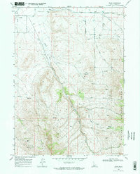
1968 Map of Basin
USGS Topo · Published 1972About this map
The small settlements of Basin and Oakley anchor this Idaho landscape, where the high desert meets the foothills of Middle Mountain. Irrigation and water management are central to the area's development, evidenced by the Aqueduct, the East Canal, and a Flume designed to direct the flow from local drainages. The map records several notable natural water sources, including the namesake Hot Spring and Worm Spring, which contrast with the dry, high-elevation terrain of the Sawtooth National Forest to the south.
Find a feature on this map
28 named features on this map. Tap any name to fly to it.
Don’t see what you’re looking for? This feature index may not catch every label — zoom into the map to look around manually.
Map Details
Editions of this 1968 Basin Map
2 editions found
Other maps of this area

1954 · Pocatello
USGS Topo · 1:250,000

1958 · Pocatello
USGS Topo · 1:250,000

1968 · Almo
USGS Topo · 1:24,000

1968 · Cache Peak
USGS Topo · 1:24,000

1968 · Basin
USGS Topo · 1:24,000
1968 · Blue Hill
USGS Topo · 1:24,000

1968 · Marion SE
USGS Topo · 1:24,000
1968 · Oakley
USGS Topo · 1:24,000

1968 · Mount Harrison
USGS Topo · 1:24,000

1968 · Lyman Pass
USGS Topo · 1:24,000